A the last minute last night July 28 2017 Jason and I decided to take a day hike. We decided on the Twin Creek section of the Twin Valley backpacking trail. Jason has done the other sections before.
We left Jason’s at 0900 and head straight for REI so we could check out some new footwear. Jason found himself a pair and I picked up a pair of La Sportiva AKYRA mountain running shoes. We then proceeded to do what you are not supposed to do, we headed for the trail with our new shoes. For brand new shoes the AKYRA’s were great. They fit my feet well and are very comfortable. The aggressive sole was very nice.
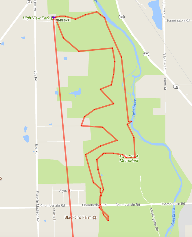
We Started the hike near 1200 and proceeded to the left and counter-clockwise direction. We started in open meadows and eventually wood. We would continue this vacation throughout the trip. There are a few water sources on the trail that may be seasonal and rain dependent. However I didn’t think about recording them until late in the day and only recorded the location of two. One of the water source is potable water provided at the Hopewell trail head off Chamberlin Rd.
The Pine ridge Camp ground has three sites and a common area for cooking. No fires are allowed in the back country camps, only backpacking stoves. Pit toilets are near the camp, no trash cans are available. Pack in pack out. The three sites are of decent size for a few small backpacker tents or one larger one. There is no trees suitable for hammocks.
We proceeded north to the Hopewell earthworks. I must say we didn’t know what to expect as we only looked at the map and hadn’t read the features. We found the trail marker and realized that the Hopewell earthworks are military earthworks or Breastworks used for defense. The earthworks are hardly distinguishable now if you aren’t looking for them as the forest has changed in the last 2000 years! Once you know about them you can see the difference in the top of the Ridgeline but nothing defined. We didn’t walk the entire earthwork.
On the east leg of the trail we found a well-worn path to the river and a decent “beach”. However I think I would wear some kind of shoes in the water and on the beach as there is some trash around.
The last leg from point 8 to 10 has many very muddy places where the sun doesn’t shine.
Overall it was a good hike. It is easy enough for the whole family. I feel we could have easily added the purple section and 2 miles. It was nice to only have camera gear and some provisions.
See our track here:Here.

Check out Jason’s video of the trip below.
Here is a screen shot of My APRS track. (amatuer radio packet reporting system)